Sorry about the delay in posting; coverage has been spotty after entering the US. I'm a couple of days behind.
Our second day took us into Québec, across the Saint Lawrence river and close to the US border. Here's my record of the route:
Laura generously drove the first leg of the day, leaving the rest of us to ride.
We left Voyageur Provincial Park through the eastern end, following a dubious-looking track and climbing over a fence in the process. It wasn't long before we reached an access road for the dam which led us out near the border to get on QC-342.


We rode through Rigaud, with a water stop - a hot sun all day had us drinking a lot.
From Rigaud we climbed up through an area of mansions and equestrian estates. This must be where the rich Montreal horsey set come to play. We were a bit apprehensive about the gravel road, but the surface was good. Some of that money must be funding lots of road maintenance...

Back on smooth asphalt, a long sweet descent led us down to prosperous-looking farms in the valley, and then a flat ride to the river.
The paths around Salaberry-de-Valleyfield were fantastic, along canals and causeways as well as segregated routes along roads. When we reached the downtown, we found it packed with people watching speedboat races in the bay.
 |
| We really needed to cool off! |


We met Laura at the Parc des Bâtisseurs on the island for a picnic lunch, and Lindsay, Rachel and Sean swapped into the van.
Supposedly only the easternmost bridge off the island is bike-friendly, so we tried to find a good route there. The next couple of hours were a demonstration of the limits of Google Maps' cycling directions...
Google refused to acknowledge the existence of a nice new bike path along the south shore, so we followed a potholed road through industrial sites for a stretch. We did cut down to the path near Pont St-Louis when the road ahead was under construction, and the path led us through shade most of the way to our targeted bridge.
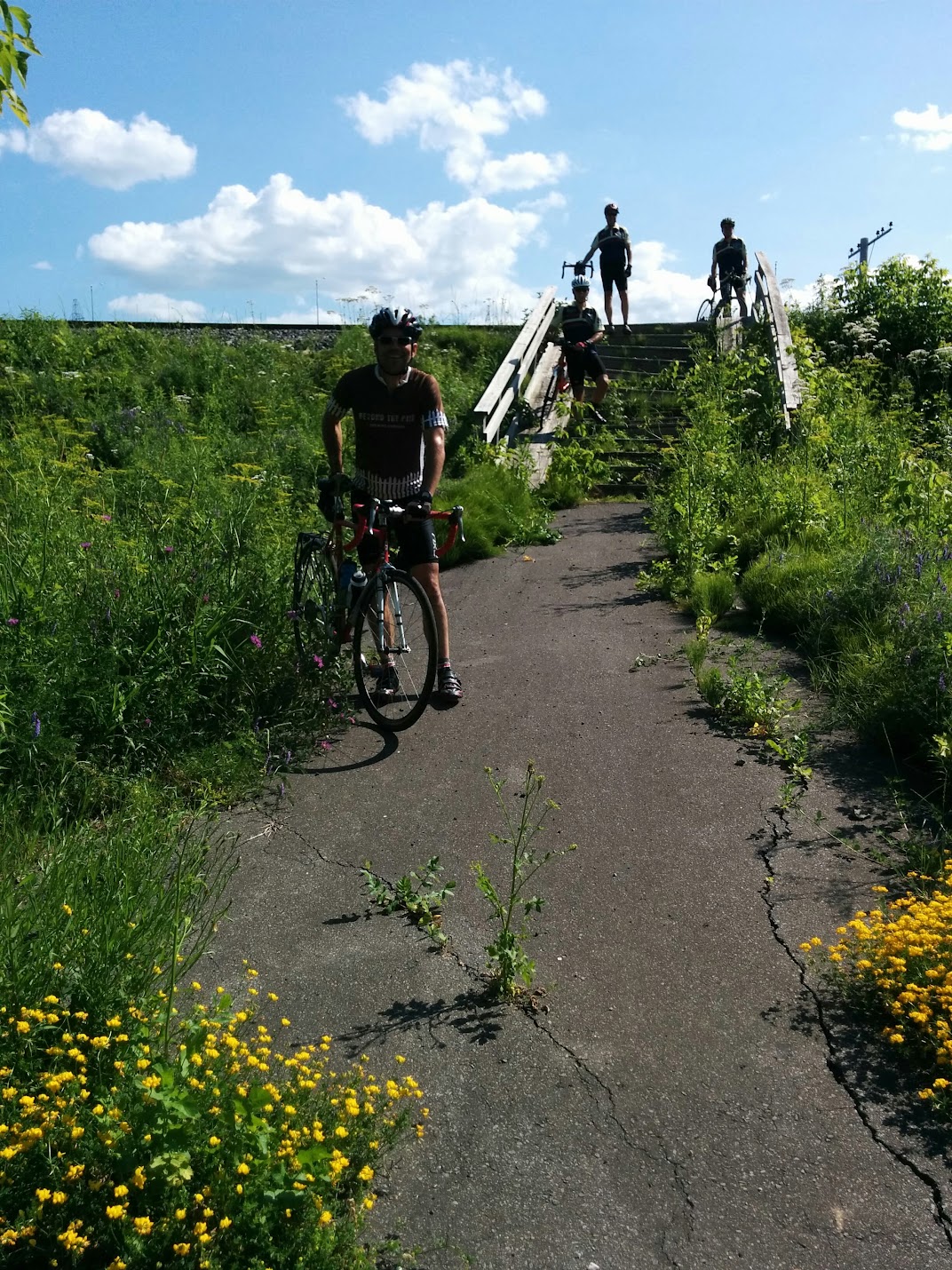
When the paved path veered away from the shore, Google insisted that we should stick to a gravel road along the water, which led to... a gated secure facility underneath a major highway bridge. This is where our hike began...
 |
| "It looks like just a 50m hike to the road..." |
 |
| But there was no getting through here... |
 |
| If we follow the tracks we'll reach civilisation eventually... |
 |
| Decaying wooden steps down from the tracks |
Search ResultsParc des Bâtisseurs on the
Search Results

When we made it back to asphalt, we stopped for refreshments at a gas station, before trying again to actually get over a bridge, finally going through a tunnel and then over a bridge past the Beauharnois hydroelectric generating station.
Once finally on the south shore of the Saint Lawrence, the journey was fairly uneventful, along relatively quiet roads and a long paved rail trail through Lacolle, the over a bridge to Noyan.
The campground ("Sleepy Hollow") was about 2km down down a riverside road. Lindsay and the kids had been there for a few hours ahead of us and reported an unlicensed snack bar a a dining option. We noted a restaurant at the crossroads advertising beer and wine, plus something about food, but we were already sold...

A few of us cycled back to the restaurant from the campground while the others rode in the van. The food was mostly very good, especially after our expectations were lowered by a laughably poor chicken soup. Imagine dissolving a chicken bouillon cube in papier-mâché paste and you'll get the idea.
We had cold showers and no drinkable water at the campground, but it was $34 for all ten of us, so we can't complain too much.
We all slept pretty early, after a long day...
No comments:
Post a Comment